
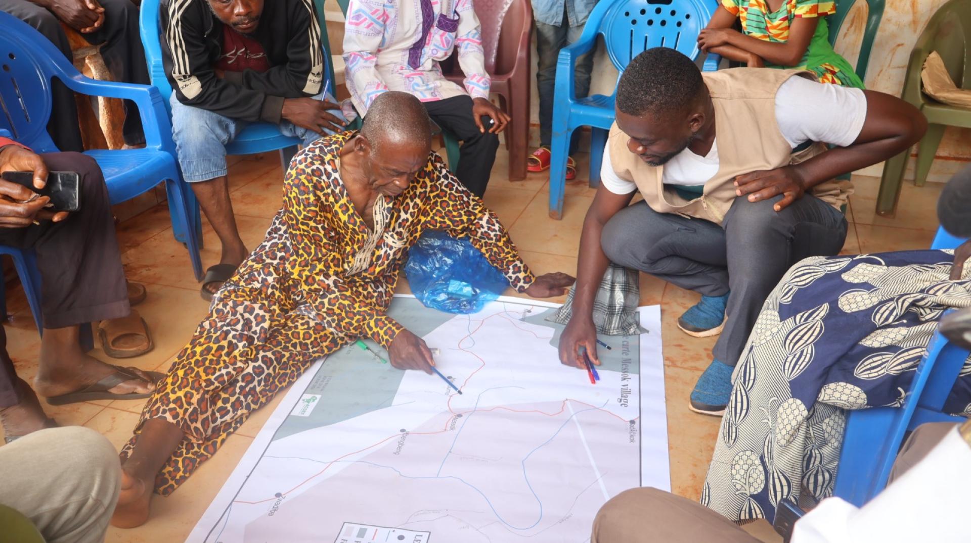
Through community-led conservation, participatory mapping and stronger local governance, Cameroon is laying the groundwork for Other Effective Area-based Conservation Measures (OECMs) in the forests surrounding the Dja Faunal Reserve.
Turning global biodiversity commitments into local action
In December 2022, countries adopted the Kunming-Montreal Global Biodiversity Framework (GBF), a global plan to halt and reverse biodiversity loss by 2030 and achieve a vision of living in harmony with nature by 2050.
At the heart of this plan is Target 3, widely known as the 30x30 target, which calls for at least 30% of the world's land, inland waters, coastal areas and oceans to be effectively conserved by 2030. This includes protected areas and Other Effective Area-based Conservation Measures (OECMs).
Achieving this target requires more than creating new protected areas. It also means recognizing and supporting other areas that deliver lasting biodiversity benefits, strengthen ecological connectivity and are governed fairly.
In Cameroon, the Dja Landscape Project is helping translate this global ambition into action on the ground.
The project, Strengthening Governance and Ecosystem Connectivity for Biodiversity Conservation and Improved Livelihoods in the Dja Landscape (GEF ID 11242), is financed by the Global Environment Facility (GEF) under its eighth replenishment cycle (GEF-8). It is implemented by the Ministry of Environment, Nature Protection and Sustainable Development (MINEPDED), with technical oversight from the United Nations Environment Programme (UNEP), acting as the GEF Agency.
The project aims to strengthen governance and ecological connectivity in the forests surrounding the Dja Faunal Reserve while improving local livelihoods.
Through Component 2, which focuses on protected area management and connectivity, the project works with partners to address deforestation, biodiversity loss, illegal logging and other pressures in the landscape. A key priority under Output 2.3 is to lay the groundwork for OECMs that address the underlying causes of forest and biodiversity loss.
Communities map the future of conservation
In 19 forest villages around the Dja Faunal Reserve, communities have spent eight months mapping the places that matter most to their environment and livelihoods.
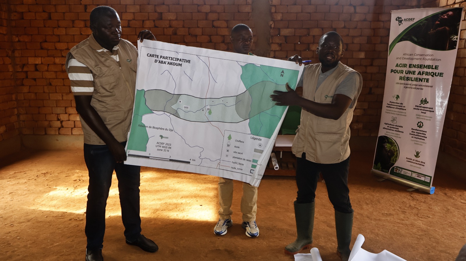
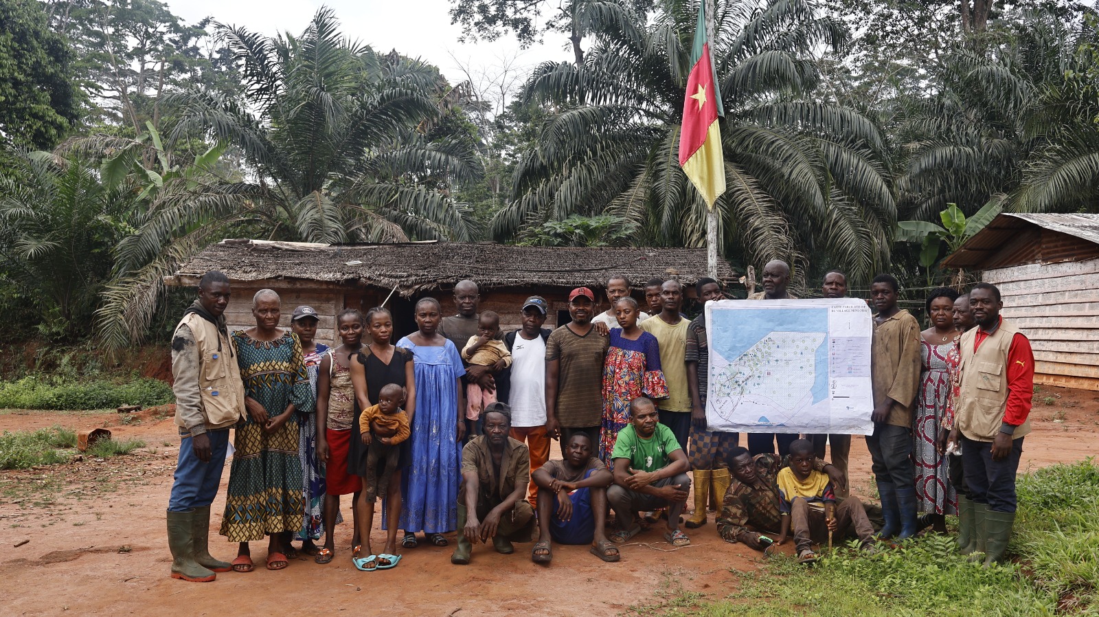
Working with the project's implementing partner, residents have identified wildlife habitats, culturally significant sites, and traditional hunting and gathering areas. Each village has validated its own map, creating a community-informed inventory of more than 100 potential High Conservation Value sites.
These maps provide an important foundation for identifying areas that could qualify as OECMs. They also bring together scientific approaches and the ecological knowledge of local and Indigenous communities.
The work is particularly significant for Cameroon. At the time of reporting, the country had no OECMs recorded in the global database hosted by Protected Planet. The Dja landscape therefore offers an opportunity to develop a credible, community-supported approach that could contribute to the country's 30x30 commitment.
The process is not yet at the designation stage. No OECMs have been formally proposed or recognized in the Dja landscape. The current work is establishing the community consent, evidence, governance arrangements and monitoring systems needed to assess and propose suitable sites.
Building the foundations for effective OECMs
ACDEF Cameroon's fieldwork for the Dja Landscape Project, covering November 2025 to June 2026, highlights progress in five key areas.
1. Securing community consent
Conservation initiatives are more likely to succeed when communities understand and support them. Consultations reached 789 people across 19 villages in the municipalities of Somalomo, Ngoyla, Messok and Lomié. Before field activities began, every village signed a Free, Prior and Informed Consent (FPIC) agreement.
This approach places community agreement at the center of the process and helps establish a legitimate foundation for future conservation areas.
2. Identifying areas of high conservation value
Through participatory mapping, communities have produced 19 validated maps, now stored in an operational geospatial database.
The process has identified more than 100 potential High Conservation Value sites. These areas will be assessed further to determine their conservation importance and suitability as candidate OECMs.
3. Strengthening wildlife corridors and ecosystem connectivity
Biodiversity conservation depends on connected habitats that allow wildlife to move between areas and maintain healthy ecosystems.
The project is finalizing preliminary maps of wildlife corridors and ecological risk areas. An awareness campaign on wildlife migration corridors reached 934 people across 19 villages. Community radio programs broadcast through CODEDEM Nkoul Melab in Lomié have also helped explain why connected habitats matter.
These activities support the wider goal of building a connected conservation landscape around the Dja Faunal Reserve.
4. Establishing community-based governance
Effective conservation requires clear management responsibilities and inclusive decision-making.
Fifteen villages have democratically selected 63 representatives for future Communal Landscape Management Commissions. The mayors of Somalomo, Ngoyla and Messok have also appointed focal points to support their establishment.
In addition, the project has profiled 72 community-based organizations that could contribute to managing and protecting these areas.
Together, these steps aim to connect community leadership with municipal institutions and create a stronger foundation for long-term conservation.
5. Developing systems to monitor conservation results
For an area to qualify as an OECM, it must deliver sustained, measurable biodiversity outcomes. The project has established and trained five pilot community wildlife monitoring committees. Members have received training in GPS, geographic information systems (GIS), remote sensing and standard monitoring methods.
A digital data collection platform is also operational at five pilot sites.
These systems will help communities and project partners track changes over time and generate the evidence needed to assess future OECMs.
Promoting inclusive and equitable conservation
The Kunming-Montreal Global Biodiversity Framework emphasizes that conservation areas must be governed equitably, with the full and effective participation of Indigenous peoples, local communities and women.
The Dja Landscape Project is working to put this principle into practice.
Of the 789 people consulted during the reporting period, 27% were Indigenous Baka, 42% were young people and 22% were women.
Women's participation remains a challenge. Male-dominated customary structures, domestic responsibilities and additional barriers faced by Indigenous women have limited their involvement. To address these barriers, the project has organized repeated consultations, adapted communication materials to local cultural contexts and adjusted meeting schedules to make participation more accessible.
The project aims for women and Indigenous peoples to represent more than 60% of its direct beneficiaries. This commitment supports the Global Biodiversity Framework’s (GBF) emphasis on inclusive participation, particularly under Targets 22 and 23, which address participation, access to justice and gender equality in biodiversity action.
Addressing the challenges ahead
While the initial results are encouraging, several challenges must be addressed before candidate sites can be formally assessed and recognized as OECMs.
- Agreeing on conservation priorities: Scientific evidence and local knowledge must be brought together to determine which areas should be prioritized. Detailed High Conservation Value and OECM assessments will help guide these decisions.
- Building trust: Some communities remain cautious because previous conservation initiatives have not always delivered clear benefits. Continued consultation, community radio, representative management structures and a project-wide grievance mechanism will help strengthen trust.
- Protecting livelihoods: Communities depend on forests for farming, hunting, fishing and non-timber forest products. Future conservation measures must take these needs into account. Livelihood initiatives will therefore accompany the next phase of assessments.
- Maintaining long-term monitoring: Community monitoring committees will need continued technical and institutional support to produce reliable data and demonstrate sustained conservation outcomes.
Addressing these challenges will be essential to ensuring that future OECMs are both ecologically effective and supported by the people who depend on the landscape.
From mapping to recognition: the next phase
The next phase will move the project from initial groundwork towards detailed assessment and implementation.
Planned activities include:
- Conducting detailed High Conservation Value assessments.
- Identifying and assessing wildlife corridors and ecological connections.
- Undertaking formal OECM assessments against the relevant criteria.
- Establishing legal Communal Landscape Management Commissions through a decree.
- Supporting livelihood initiatives that complement conservation.
- Strengthening community monitoring and long-term management systems.
Sites that meet the applicable criteria could then be submitted for national recognition and, where appropriate, reported to the global OECM database. This would create a pathway for the Dja landscape to contribute to Cameroon's progress towards Target 3.
Recognition will depend on the results of these assessments and the ability of candidate areas to demonstrate lasting conservation outcomes and equitable governance.
Why the Dja approach matters for the Congo Basin
The experience emerging from the Dja landscape offers lessons for Cameroon and other Congo Basin countries working to meet ambitious biodiversity targets while supporting communities that have long depended on forest resources.
The approach demonstrates four important principles.
Conservation can build on existing community stewardship. OECMs provide a way to recognize areas that deliver lasting biodiversity benefits beyond formally designated protected areas, without automatically requiring new protected-area restrictions]
Connectivity matters as much as coverage. Identifying wildlife corridors and linking habitats can strengthen conservation across the wider landscape,
Community participation builds legitimacy. Starting with consent and developing governance and monitoring systems before seeking recognition helps lay the foundation for credible, locally supported conservation.
Biodiversity and livelihoods must advance together. Protecting the forests around the Dja can contribute to safeguarding habitats for threatened species, maintaining carbon-rich ecosystems, supporting the ecological integrity of a World Heritage Site and sustaining local livelihoods.
The Dja Landscape Project also contributes to the wider objectives of the GEF and the GBF by linking biodiversity conservation with inclusive governance, gender equality and environmental and social safeguards.
A community-led pathway towards 30x30
Cameroon's progress towards the global 30x30 target will depend not only on national commitments, but also on practical action in landscapes where biodiversity and human livelihoods are closely connected.
In the Dja, that work is already underway. Nineteen villages have mapped areas important to their environment and culture. Community representatives are being selected, monitoring systems are taking shape, and the groundwork for future OECMs is being established.
The next challenge is to turn this foundation into formally assessed, effective and equitably governed conservation areas.
By placing community consent, local knowledge and long-term stewardship at the center of the process, the Dja Landscape Project is helping Cameroon explore a practical pathway towards its 30x30 commitment—one built village by village, with biodiversity and livelihoods at its heart.