The CBLI brings together two cornerstone programmes: The GEF-funded Congo Forest Integrated Programme (Congo Forest IP) and the IKI-funded Congo Basin Peatlands Project. Implemented by UNEP in partnership with governments, civil society, Indigenous communities, and the private sector, we strive to advance a regional landscape approach that safeguards forests, restores degraded areas, and mobilizes climate finance.
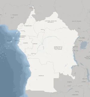
Our Geographic footprint
With its objective of supporting forest conservation and sustainable management through a regional landscape approach, promoting regional dialogue, collaboration, and climate-finance mobilization across the Congo Basin, the Congo Forest IP ( GEF7: 2021-2026 and GEF8- Congo Critical Forest Biome Integrated Programme-: 2025-2030) and its regional coordination span eight nations, listed in alphabetical order Along the landscape covered), with a Regional Coordination Project (RCP) to ensure coherence and maximize impact:
- Angola : Mayombe
- Cameroon: Sangha Tri-National & Tri-National Dja- Odzala-Minkebe, Campo Ma’an/Rio Campo,
- Central African Republic: Ngotto Forest landscape and Mbaéré-Bodingué National Park, Oubangui.
- Democratic Republic of the Congo: Lac Télé-Tumba, Grand Kivu, Mayombe, Oubangui, Maï Ndombe
- Equatorial Guinea: Campo Ma’an/Rio Campo, Monte Alen transboundary landscapes, Atlantic coastal forest
- Gabon : Lopé-Okanda, Mayombe
- Republic of the Congo : Lac Télé-Tumba, Mayombe
- São Tomé and Príncipe : Atlantic coastal forest, Obô Natural Parks & Atlantic coastal forests
The Congo Basin Peatlands Project, supported by IKI aims at securing biodiversity, carbon, and water stores in the Congo Basin Peatlands through governance and evidence-based decision making focusing on the Democratic Republic of the Congo and the Republic of Congo. Together, these two cornerstone programmes allow a coordinated, multi-donor effort that aligns transboundary and national actions, shared knowledge, governance, and investments to maximize landscape resilience and Transparent, ongoing updates as sites, partners, and investments evolve
See the maps below from MAPEX for a visualization of our scope, project footprints, and landscape interactions.