The Congo Basin peatlands are among the world’s most important natural assets for climate, water, and biodiversity. Potential future infrastructure expansion, changes in land use, and intensifying climate variability could place growing stress on these waterlogged ecosystems, threatening their ecological integrity and their role as a global climate stabilizer.
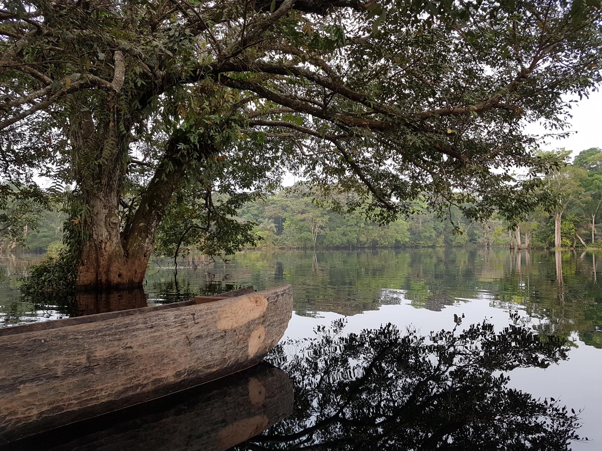
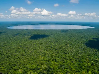
Spanning approximately 167,600 square kilometers across Central Africa (read the article), the Congo Basin peatlands hold an estimated 29 gigatons of carbon —equivalent to nearly two years of global CO₂ equivalent emissions. Beyond carbon storage, these peatlands sustain freshwater systems, support rich and unique biodiversity, and underpin the livelihoods and cultural heritage of communities across the region. Given their critical importance for climate mitigation, biodiversity conservation, water regulation, and local livelihoods, the sustainable management of these peatlands is a core priority of the Congo Basin Landscapes Initiative (CBLI), which promotes integrated, science-based, and inclusive approaches to landscape governance across the Basin.
The United Nations Environment Programme (UNEP), with support from the German Government through the International Climate Initiative (IKI), and in collaboration with national, regional, and international partners, has advanced an initiative to strengthen understanding and inform sustainable management of these ecosystems in the Lac Télé–Lac Tumba landscape of the Congo Basin. Central to this effort is the development of a Hydrological Decision Support System (HDSS)—a robust, science-based tool designed to support evidence-based decision-making by integrating hydrological modeling and peat carbon dynamics to inform development-related decisions in the landscape.
A Robust, Science-Based tool for Decision-Making
At the core of the HDSS is a coupled hydrological and carbon balance model that captures key processes governing water movement and peat carbon dynamics in a modeled peat dome of the landscape.
Experts from UNEP-DHI simulated water dynamics across a 40 km transect of a peat dome (2000–2019), distinguishing between two dominant hydrological regimes: rain-fed peatlands and river-fed peatlands. This hydrological model is coupled with a complementary carbon model, which links surface water level to peat decomposition by differentiating between oxic (oxygen-present) and anoxic (oxygen-limited) conditions. Together, these models allow the HDSS to estimate how different scenarios such as drainage, land-use change, or climate-driven drying could alter water level, peat decomposition rates and carbon fluxes—providing a clearer basis for assessing the implications of development choices.
Importantly, the HDSS is designed as a decision-support tool for comparing outcomes from different scenarios. Significant data gaps remain—particularly related to river flows, groundwater dynamics, and peat properties—meaning results should be interpreted with caution and progressively refined as new field data become available.
Co-developed scenarios, locally relevant insights
Between 2023 and 2025, UNEP and UNEP-DHI worked with national authorities, local experts, civil society, and community representatives in Brazzaville and Kinshasa to identify realistic, locally relevant development scenarios for the Lac Télé-Lac Tumba landscape. The work focused on seven small-scale interventions (e.g., roads, settlements, fire, deforestation, oil palm plantation), combined with three climate scenarios and two hydrological regimes, resulting in 42 modeled scenarios.
What the results show
Across scenarios, one message stands out: Securing water table levels is essential for peatland health.
- Drainage-based interventions consistently lower water levels, increase oxic depth, and lead to significant carbon losses—often extending beyond the immediate project area.
- Non-drainage activities tend to have more localized impacts, though climate change still increases peat decay.
- Under both moderate (SSP1-2.6) and severe (SSP3-7.0) climate futures, higher evapotranspiration is projected to lower water levels and accelerate peat decomposition, even in the absence of new development.
These findings underline the need for a precautionary approach, particularly in relation to any development that involves drainage.
Pathways for Governance, capacity, sustainable management and next steps
In line with the CBLI’s integrated landscape approach, the study identifies five priority actions for the Lac Télé–Lac Tumba landscape:
- Maintain high water levels — where drainage is unavoidable, limit its depth and duration.
- Protect vegetation — conserve peat swamp forests and riparian buffers to sustain hydrological function and biodiversity.
- Minimize surface disturbance — avoid large-scale land smoothing or compaction that disrupts natural water flows.
- Use adaptive drainage management — apply adjustable water-control structures that respond to seasonal variability.
- Strengthen long-term monitoring — build sustained data collection on water levels, peat condition, and ecosystem health.
Download the Securing Crucial Biodiversity, Carbon and Water Stores in the Congo Basin Peatlands : Report on Development and Climate Change Scenarios | Model Documentation of the Hydrological Decision Support System - Technical Report