The most effective conservation strategies emerge when traditional knowledge meets modern planning systems, supported by targeted capacity building. This principle is being demonstrated across multiple countries in the Congo Basin, transforming conservation practice in the Republic of Congo's Lac Télé landscape, to participatory land use planning covering over 1.2 million hectares in Cameroon and transboundary conservation efforts spanning Equatorial Guinea, Cameroon, and Gabon.
A New Model for Landscape Governance
The Enhanced Integrated Land Use Management Planning (ILUMP) methodology that forms the basis for these updated land use management plans in the villages of the Lac Télé Community Reserve and in the shared landscapes of Cameroon, Gabon and Equatorial Guinea, represents a paradigm shift in forest conservation.
What makes this enhanced ILUMP methodology groundbreaking isn't just its technical sophistication—though its integration of natural capital accounting (NCA), climate vulnerability assessments, and ecosystem services valuation represents a major advancement. It's also the methodology's foundational commitment to recognizing customary tenure rights and empowering Indigenous Peoples and Local Communities (IPLCs) as equal partners in formal planning processes.
The Power of Natural Capital Accounting
Central to this methodology's success is natural capital accounting (NCA)—a globally recognized framework for assessing ecosystem stocks and flows. Rather than abstract environmental assessments, NCA provides clear economic valuations of forest ecosystem services, from carbon storage and water regulation to biodiversity conservation and non-timber forest products. This quantification enables communities and policymakers to make informed land use decisions that account for both immediate economic needs and long-term environmental sustainability. For more information on natural capital accounting, please refer to our explainer.
Expanding Success Across the Congo Basin
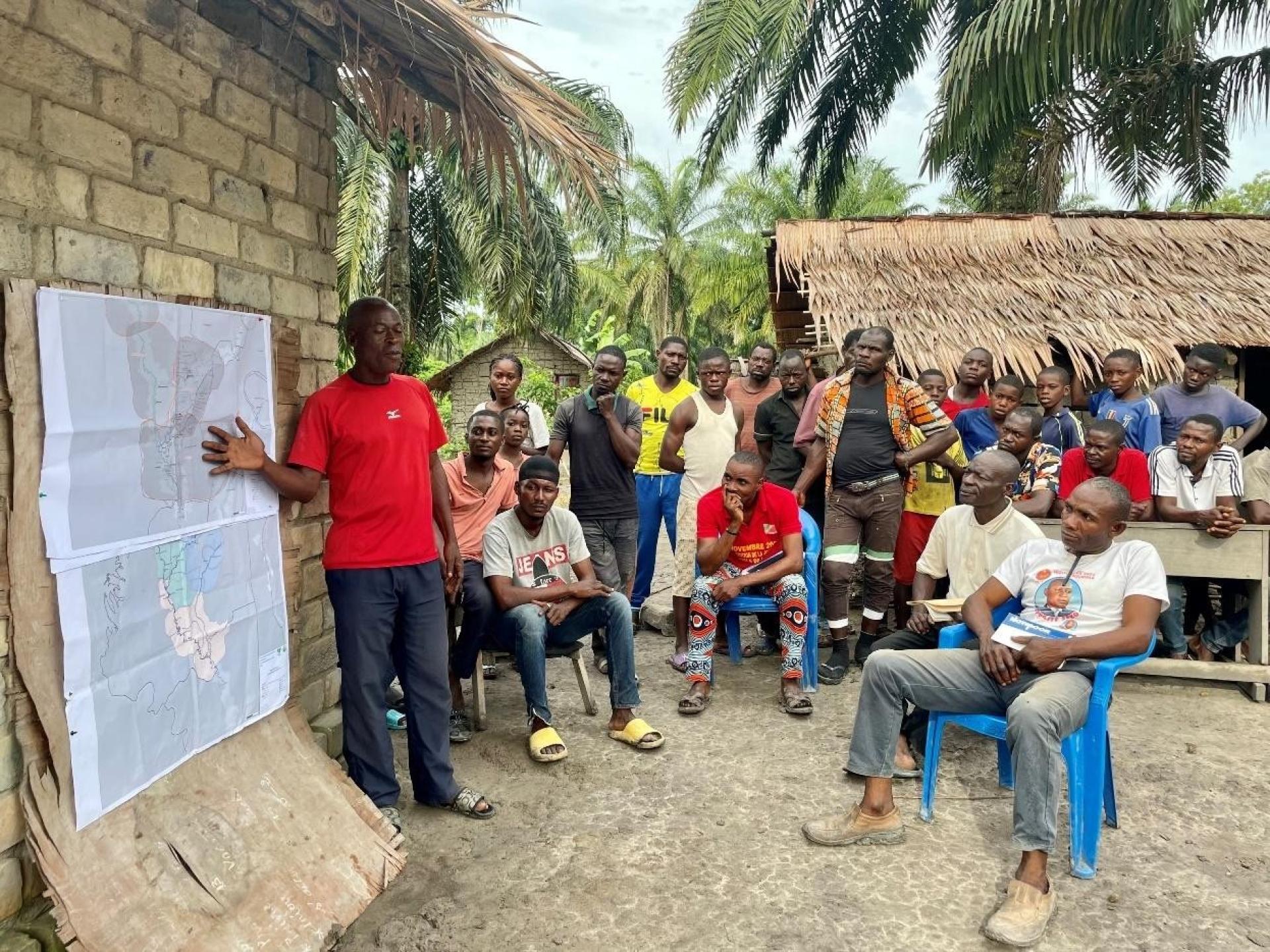
The process exemplifies true participatory democracy, at the community level. In the Republic of Congo, developing the Lac Télé Community Reserve Management Plan involved extensive Free, Prior and Informed Consent (FPIC) processes, with 941 men and 421 women from 27 villages directly participating in mapping exercises incorporating natural capital assessments. Community members defined core protection zones, updated village management plans, and shaped conservation strategies based on their intimate ecosystem knowledge and understanding of economic value. The process was further strengthened through two technical workshops in the Lac Télé area, in the towns of Ouesso and Impfondo, where 60 participants from communities, governments and development partners came together to address peatland governance, illegal wildlife trade, and cross-border cooperation.
This participatory approach in Lac Télé is creating a replicable model that demonstrates how community-led conservation can achieve both biodiversity protection and sustainable development outcomes.
In Cameroon, communities have produced pre-validated PLADDT (Local Sustainable Land Development and Management Plans) documents covering over 1.2 million hectares across Ngoyla (816,087 ha) and Mintom (381,431 ha) council areas. These formally recognized plans integrate community knowledge with scientific data and economic valuation, bridging traditional resource management and modern governance systems. Also in Cameroon, two ILUMPs were developed and pre-validated through participatory consultations involving 52 villages in Mintom and 28 in Ngoyla, with stakeholders trained in natural capital accounting and comprehensive diagnostic reports and ecosystem asset maps produced.
The Congo Forest IP is rolling out Integrated Land Use Management Planning across multiple transboundary landscapes, with significant progress visible in Equatorial Guinea, Cameroon, and Gabon. In Equatorial Guinea, four ILUMPs using this methodology for the Monte Alen and Rio Campo transboundary landscapes were elaborated through participatory processes integrating inputs from government agencies, local communities, civil society, and conservators during cross-border dialogues with Cameroon and Gabon. This transboundary success showcases the methodology's potential to transcend national borders, creating a foundation for regional conservation strategies that respect both ecological connectivity and diverse community needs across multiple countries.
A Model for Global Application
The implications extend far beyond Central Africa. As countries around the world implement the Kunming-Montreal Global Biodiversity Framework and pursue Sustainable Development Goals, this enhanced ILUMP methodology combined with a participatory, community-based approach, offers a proven pathway for harmonizing conservation with development while centering on community rights and acknowledging economic realities.
Pioneering a New Path Forward
Building on lessons learned around the integration of natural capital accounting and climate change aspects into ILUMP tools, the Congo Basin Landscapes Initiative (CBLI) is focused on enhancing institutional and community-level capacity for data generation, collection, and inter-partner information exchange. By fostering a data-driven culture grounded in respect for local socio-cultural norms, the project aims to strengthen evidence-based integrated land-use planning. These efforts lay the groundwork for long-term sustainability and provide a foundation for exploring future opportunities, such as innovative finance mechanisms and cross-regional knowledge exchange, to further support conservation and development goals. It is building on the technical foundation to add carbon and ecosystem services market development, impact verification methodologies, and develop best practices guidelines based on International Finance Corporation standards.
As the Congo Basin forest faces increasing pressures from deforestation, climate change, and economic development, these innovative approaches to valuing the forest ecosystem offers real world adaptations and hope for a different path. One where conservation strategies emerge from the ground up, where traditional knowledge is valued alongside scientific expertise, and where communities are partners rather than beneficiaries in shaping their landscape's future.
Please click here for more information about how the Congo Basin Landscapes Initiative is developing and rolling out the Enhanced Land Use Management Planning at the regional, political level. You can find our explainer on natural capital accounting here.
Photo credit: © A. Scrizzi / WCS
More information about the Congo Basin Landscapes Initiative on www.congolandscapes.org